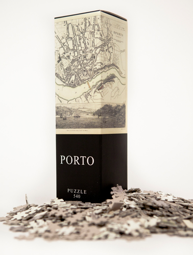
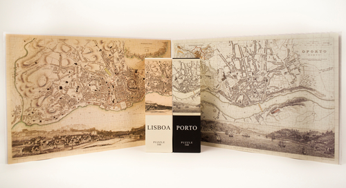
Oporto Puzzle. Mapa antiguo. 540 piezas (50x35cm)
Architoys
Editorial: Architoys
Referencia: 0806802602653
Edición: 1
Número de páginas: 540
Tamaño: 50 x 35
Este mapa do Porto foi desenhado em 1833 pelo arquitecto W.B.Clarke para a Society for the Diffusion of Useful Knowledge (UK), e publicado num atlas por Baldwin & Cradock. A SDUK foi fundada em 1826 por Lord Henry Brougham, um estadista inglês que acreditava na promoção do autodidactismo e na divulgação do conhecimento para as classes trabalhadoras e para a burguesia que não tinha condições de acesso a um ensino qualificado. As publicações da SDUK tratavam de argumentos considerados uteis como história, geografia ou zoologia de forma acessível para quem tinha acabado de aprender a ler, para melhorar a leitura e aumentar o conhecimento. Entre várias publicações a SDUK editou vários atlas excelentes. Na altura não existia nada igual no mundo pela qualidade e pelo preço. This city map of Porto was drawn in 1833 by the architect W. B. Clarke for the Society for the Diffusion of Useful Knowledge (UK) and published on an atlas by Baldwin & Cradock. The SDUK was founded in 1826 by Lord Henry Brougham, a british statesman that believed in the promotion of self-education and the disclosure of the knowledge for the working classes as for the bourgeoisie that could not make use of experienced teachers. The SDUK publications were dealing with useful subjects as history, geography, zoology in an easy way to support those who had just learned to read to improve their reading skills and knowledge. Among several publications, the SDUK published some extraordinarily detailed atlas. At the time there was nothing like that anywhere in the world for its quality and price.
